“Zürich virtuell” and “Zürich 4D” invite you to explore the city from completely new perspectives, writes the Office of Urban Planning in its latest media release. The two new websites allow a freely selectable 3D-view of Zurich and its more than 50,000 buildings. With “Zürich 4D”, the architectural development of the city can be followed from the past into the future. According to the media release, the applications should work on any web browser.
The two new web apps bring the 3D city model to the general public: in “Zürich virtuell”, glide through the digital twin of the city from any angle. In an interactive web map, the current and projected buildings, trees, forests and bridges can be easily visualised – for an exact view of Zurich. The simulation of shadows cast over time and over the course of the year is also interesting. And via the simple address search, you can find any building in the entire city.
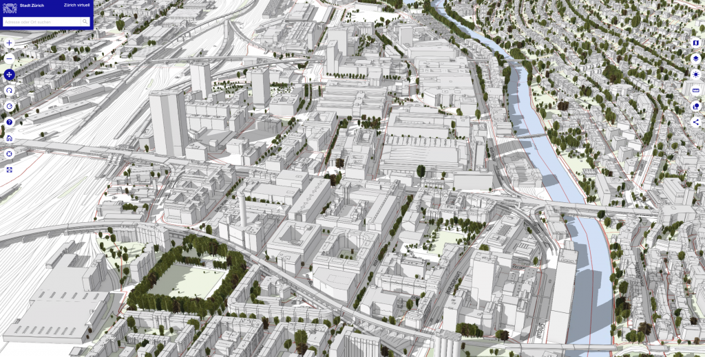
“Zürich virtuell” allows you to view the city from freely selectable angles and zoom levels.
The “Zürich 4D” application, which was released at the same time, focuses more on building development in space and time: the interactive web map can be used to visualise current building construction projects, design plans and completed architectural competitions. The app also contains a timeline from 20101 to the medium-term future. All the data on which the two apps are based are regularly updated and most of them are also freely available to the public as open data.
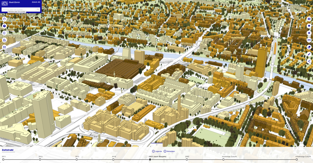
The web app “Zürich 4D” in the view with the dates of origin of the buildings – here in Zürich-West.
The 3D city model provides the basis for both new applications. The most popular freely accessible geodata set of the city of Zurich has been downloaded from the geoportal over 4500 times since the end of 2018. Now this data can be easily displayed in a playful way. Users can, for example, measure the height of the buildings shown or call up further information on them at the click of a mouse.
Both applications are primarily aimed at all actors in the building sector: planners, architects or engineers. The numerous visualisation and analysis options make it possible to work at different scales – from the overall city view to the detailed building model. The underlying technology is already used within the administration for the visualisation of noise simulations, in the context of architectural competitions or for the integral representation of civil engineering and building construction projects.
However, the apps are also intended for use in schools or for the documentation of real estate and ultimately for everyone. “Zürich virtuell” and “Zürich 4D” were developed as part of the city council’s “Digital City” strategy focus and are part of the so-called “digital twin”, the digital representation of the city of Zurich. Further offers can be integrated into the developed digital infrastructure on an ongoing basis.